

How to access and use the Milestone Society databases
Our database is split by the feature type (milestone, boundary marker etc.) as listed in the key below.
The main milestone file has been split into English regions, Wales, Scotland and Ireland to make it quicker to load and easier to find the ones for your local area. The boundary markers are also split into north and south.
On the map home page each feature type has its own coloured icon as indicated in the list below. If you hover over the icons a text box will appear with the layer name. These are also listed in a pop-up information box that can be opened by clicking the i sysmbol and closed using the X in the top right hand corner of the box.
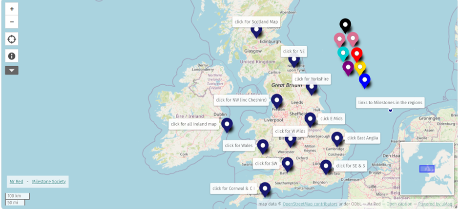
Click on one of the coloured icons then select the Go To hyperlink. This will populate the map with pin symbols for all the items in that database. Zoom into the map. As you hover over a pin the item database reference ID will appear. Clicking on the ID will produce a pop-up information box about that feature.
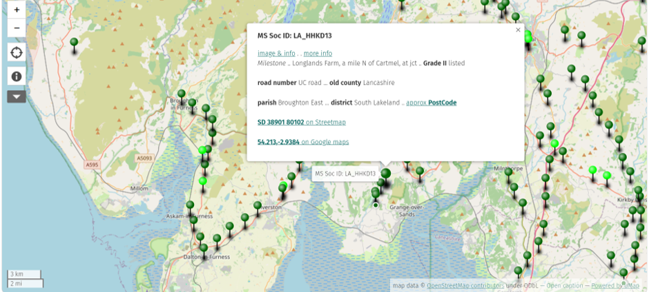
The information box provides location details with options for the Ordnance Survey Grid Reference, Lat/ Long or What3Words. You can also view on Google Maps.
There may also be a link to the feature on historic OS mapping via the National Library of Scotland website
Photographs, where available, are stored in the Milestone Society's account on the Geograph.org website.
Information on parishes in the map files is provided courtesy of Historic England.

| Layer | Contents | Icon | Issue Date |
|---|---|---|---|
| Milestones | milestones and inscribed guideposts pre-1939 |  |
August 26 |
| Boundary Stones | boundary markers & pre-1939 commemorative waymarkers |  |
August 26 |
| Wayside & other Crosses | stone crosses and uninscribed guide posts |  |
August 26 |
| Modern Waymarkers | new milestones and waymarkers since 1939, excluding replacements |  |
August 26 |
| Canal Milestones | canal milemarkers |  |
August 26 |
| Fingerposts | fingerposts & village entry signs |  |
August 26 |
| AA Signs | AA signs |  |
August 26 |
| Tollhouses | tollhouses |  |
August 26 |